My contributions

Level Design
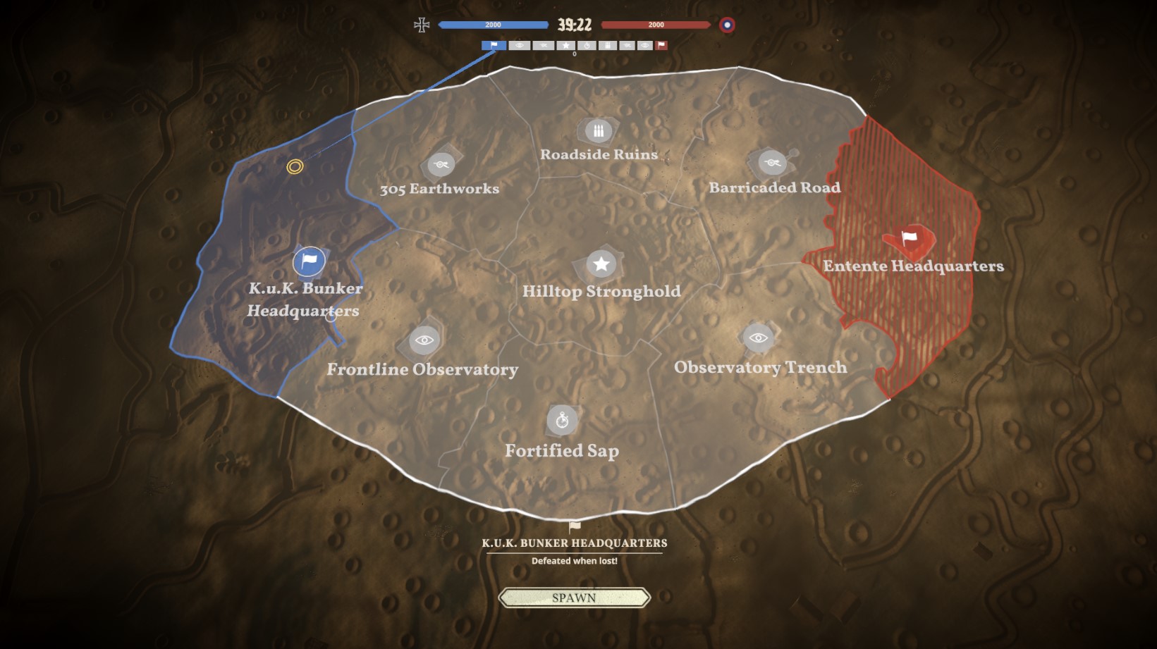
For Tannenberg my main focus was the Ukraine map that can be seen in the trailer above. The initial rough layout is based on real-life geo data, but since most Tannenberg map follow this 1-2-3-2-1 area format to improve walking routes (picture left), Level designers had to take a lot of liberties in placing gameplay components like (optional) objectives, trenches, landmarks and other important elements. This all to make each shortest route from any objective to another interesting, fair and feel like a natural path for player wayfinding, even when it clearly isnt.
We did periodic playtesting to ensure the maps remained fair for both sides, and generally fun to walk around between objectives, with things like storytelling through prop placement, diverse cover elements, environmental storytelling like craters and

Programming
Examples of the sort of technical (C#) work I helped out with include (Ingame) GUI implemenation, controller support and tools for level design like a system using Bezier curves to carve out terrain all the while placing the first rough pieces for trenches. This allowed for quick iteration on maps during the early stages particularly